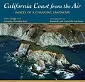
In a state identified with change, California's 1,100-mile coastline lives up to the reputation. Storm waves attack sea cliffs, earthquakes trigger landslides, and ocean waves relentlessly move sand. Over the past century, humans have changed the coast too, particularly in Southern California, where some stretches of coastline have been completely altered.
Thanks to the California Coastal Records Project, the brainchild of Kenneth and Gabrielle Adelman, we now have an aerial photographic record of the entire coastline, from the redwood forests near the Oregon border to the urbanized shoreline of San Diego Bay. California Coast from the Air features 150 of the best photographs from this scientifically valuable yet truly artistic collection of more than 80,000 images. Steep coastal cliffs gradually sliding into the ocean, an isolated sandy beach that cannot be reached by road, or sand dunes marching inland under the force of the wind are just a few of the scenes portrayed in the book's photos. Oceanographer Gary Griggs and architect Deepika Shrestha Ross provide insightful captions, describing the natural features, their changes over time, and human efforts to tame them. The photographs are organized by county, from north to south, and shaded-relief maps locate features described in the text.
