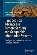
This book presents the latest advances in remote-sensing and geographic information systems and applications. It is divided into four parts, focusing on Airborne Light Detection and Ranging (LiDAR) and Optical Measurements of Forests; Individual Tree Modelling; Landscape Scene Modelling; and Forest Eco-system Modelling.
Given the scope of its coverage, the book offers a valuable resource for students, researchers, practitioners, and educators interested in remote sensing and geographic information systems and applications.
Inhalt
Innovations in Remote Sensing of Forests.- Overview of LiDAR Technologies and Equipment for Land Cover Scanning.- Software Tools for Terrain and Forest Modelling.- Data Fusion for Evaluation of Woodland Parameters.- Tree Modelling in Virtual Reality Environment.- Realistic Tree Modelling.- Digital Modelling of Terrain Surface.- Texturing of Landscape Scenes.- Large Scene Rendering.- Scene Rendering under Meteorological Impacts.- Lighting and Shadows Rendering in Natural Scenes.- Modelling of Forest Ecosystems.
Titel
Handbook on Advances in Remote Sensing and Geographic Information Systems
Untertitel
Paradigms and Applications in Forest Landscape Modeling
EAN
9783319523088
ISBN
978-3-319-52308-8
Format
E-Book (pdf)
Hersteller
Herausgeber
Genre
Veröffentlichung
24.02.2017
Digitaler Kopierschutz
Wasserzeichen
Dateigrösse
9.54 MB
Anzahl Seiten
415
Jahr
2017
Untertitel
Englisch
Unerwartete Verzögerung
Ups, ein Fehler ist aufgetreten. Bitte versuchen Sie es später noch einmal.
