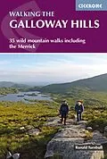
A guidebook to 34 day walks and one long-distance route in the wild and remote hills of Galloway. Although there are some shorter and easier routes, many of these hill walks are long and on rugged terrain, so are more suitable for experienced walkers.
The day walks range from 4-33km (2-20 miles) and can be enjoyed in 2-11 hours, with options to combine routes to form longer days. A 3-day trek covering 82km (53 miles) is also detailed.
- 1:50,000 OS maps included for each walk
- GPX files available to download
- Easy access from Newton Stewart, Glentrool village, Loch Trool, Dalmellington, Carsphairn and St John's Town of Dalry
- Detailed information on planning, bothies and the history of the area
- Sized to easily fit in a jacket pocket
Autorentext
Ronald Turnbull was born in St Andrews, Scotland, into an energetic fellwalking family. His grandfather was a president of the Scottish Mountaineering Club, and a more remote ancestor was distinguished as only the second climbing fatality in Snowdonia. In 1995 Ronald won the Fell Running Association's Long-distance Trophy for a non-stop run over all the 2000ft hills of Southern Scotland; his other proud achievements include the ascent of the north ridge of the Weisshorn and a sub-2hr Ben Nevis race. He enjoys multi-day treks, through the Highlands in particular, and has made 21 different coast-to-coast crossings of the UK. He has also slept out, in bivvy bag rather than tent, on over 80 UK summits. Outside the UK he likes hot, rocky areas of Europe, ideally with beaches and cheap aeroplanes. Recently he achieved California's 220-mile John Muir Trail and East Lothian's 45-mile John Muir Way in a single season, believing himself the first to have achieved this slightly perverse double. He has also started trying to understand the geology of what he's been walking and climbing on for so long. Ronald lives in the Lowther Hills of Dumfriesshire, and most of his walking, and writing, takes place in the nearby Lake District and in the Scottish Highlands. His recent books include The Book of the Bivvy, and walking/scrambling guides Loch Lomond and the Trossachs, The Cairngorms and Ben Nevis & Glen Coe, as well as Three Peaks Ten Tors a slightly squint-eyed look at various UK challenge walks. He has seven times won Outdoor Writers & Photographers Guild Awards for Excellence for his guidebooks, outdoor books (including Book of the Bivvy), and magazine articles. He has a regular column in Lakeland Walker and also writes in Trail, Cumbria and TGO (The Great Outdoors). His current, hopelessly ambitious, project is to avoid completing the Munros for at least another 20 years.
Klappentext
This guide covers 34 day walks and one long-distance route in the wild and remote hills of Galloway. Although there are some shorter and easier routes, many of these hill walks are long and on rugged terrain, so are more suitable for experienced walkers. The walks cover the evocative areas of The Merrick, The Awful Hand, The Rhinns of Kells, the Minnigaff hills and Cairnsmore of Fleet, among others. The guide uses OS 1:50,000 maps with detailed route descriptions and photos accompanying each route. Key information such as distance, time, and ascent are given. A harshness grade gives an indication of how rough the ground is expected to be, and suggestions of variants, shortcuts and ways to extend each walk are also given. The Galloway Hills are small, but special. They stretch just 15 miles from west to east, and 25 miles north to south almost as small as Snowdonia. Within this largely pathless area there are 28 summits over 2000ft (600m) including four Corbetts. Plenty of background information is given on the region's fascinating and important history.
Inhalt
Map key Overview map Introduction Harshness and heather Geology of the Galloway Hills Wildlife and wet Free Forest of Buchan Forest park and biosphere Climbing and scrambling When to walk Getting here, getting around, staying the night Maps and GPS Safety in the hills Using this book Section 1: Glen Trool Route 1 Water of Minnoch and Glen Trool Route 2 Water of Trool Route 3 Around Loch Trool Route 4 Fell of Eschoncan to Bennan Route 5 Merrick and Rig of the Buchan Route 6 The Three Lochs Route 7 Craignaw Route 8 Craiglee and Rig of the Jarkness Route 9 Mulldonoch to Curleywee Route 10 Caldron of the Merrick Section 2: The Awful Hand Route 11 Kirriereoch Hill and Merrick Route 12 The Awful Hand: Shalloch to Benyellary Route 13 Shalloch on Minnoch Route 14 Craigmasheenie and Shiel Hill Section 3: Loch Doon Route 15 Craiglee of Doon Route 16 Hoodens Hill and Mullwharchar Route 17 Northern Rhinns of Kells from Loch Doon Section 4: The Glenkens Route 18 Garryhorn and the northern Rhinns of Kells Route 19 Cairnsmore of Carsphairn Route 20 Craig of Knockgray Route 21 Corserine from Forrest Lodge Route 22 Southern Rhinns of Kells Route 23 Mulloch Hill Route 24 Waterside Hill Route 25 Dunveoch Section 5: Talnotry and the south Route 26 Larg Hill to Curleywee Route 27 Curleywee by Stronbae Hill Route 28 Millfore Route 29 Cairnsmore of Fleet from the north Route 30 Cairnsmore of Fleet from the south Route 31 Clints of Dromore Route 32 Knockman Wood Route 33 The Thieves Stones Route 34 Wood of Cree Section 6: Expeditions Route 35 Not the Southern Upland Way Other routes Appendix A Route summary table Appendix B The bothies Appendix C Information points
